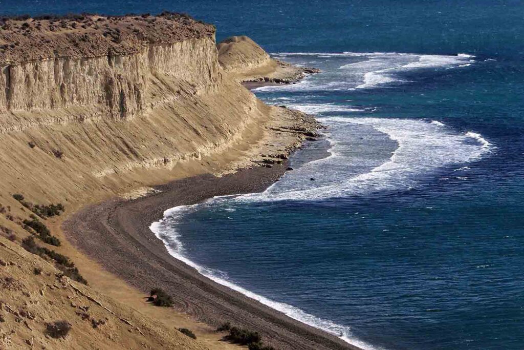
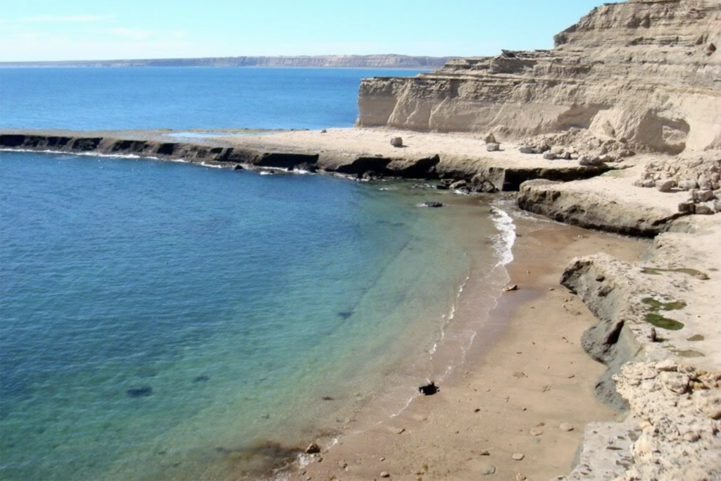
Peninsula Valdes When to Go
When to go
Argentina is so big that each region has its own climate. This means that there is always somewhere to go, whatever the time of year. Summer is from December to March, Spring from September to November, Autumn from March to May and Winter from June to August.
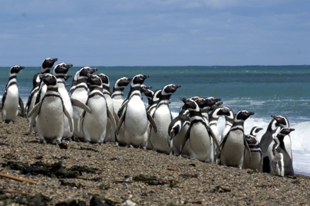
Generally speaking, the best time to visit Patagonia is from October to April, or between June and September for skiing. If you are interested in fauna watching, you should not miss the largest Magellan Penguin Colony of Patagonia which is located in Punta Tombo.
PUNTA TOMBO PENGUIN COLONY
Punta Tombo is the most important Magellan Penguin Colony in Patagonia.
Almost a million of penguins arrive at this every year in order to breed. The first penguins arrive in September and stay here up to mid-March but the best season to see them is after November, once the babies are born.
One of the greatest features of this natural reserve is the fact that you can literally walk among the penguins, follow them and learn their habits, see how they feed their babies, the rites of pairing, the fights for the defense of their territories, how they build their nests, and the restless walks they take to and from the sea. In other words, you can closely watch these tender little animals like you never imagined you could...
There is one requirement: even if you are inches away from a penguin, you must never touch or bother it. You must not forget (not even for a moment) that you are inside a fauna reservation, a special place devoted to preserve this species and its natural habitat. Besides, although penguins are harmless and they are not aggressive at all, if they feel threatened they will defend themselves with their strong, sharp beak.
This fauna reservation was created in 1979, by means of a decree of the Chubut Province, with the purpose of protecting one of the sites with the most diverse fauna within Argentina, and the greatest continental Magellan Penguins colony.
General Features
Punta Tombo is surrounded by the typical lonesome and arid landscapes of the Patagonia Plateau. But its emptiness is just an illusion; if you learn to observe in detail, you will discover all the life wealth hidden in its bushes and under the endless looking sky. Of course, there are also lambs (typical Patagonian livestock), as well as guanacos and choiques (ostriches), maras (Patagonian hares), foxes, and martinetas.
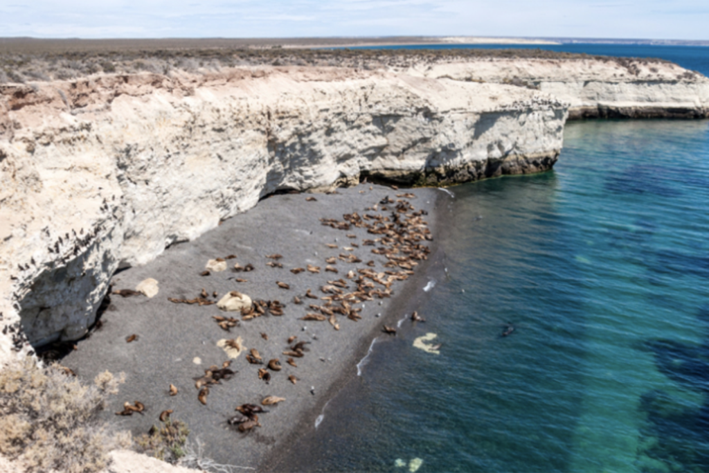
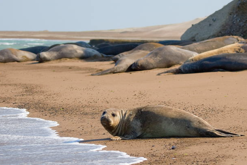
Once you start getting closer to the coast, you will be surprised by a hectic fauna activity. This rocky territory hosts a great quantity of sea birds: southern seagulls, skúas, royal and black necked cormorants, Antarctic pigeons and petrels. Also, these coasts are frequently visited by sea lions as well as the southern whales, dolphins and orcas.
Whale-watching season
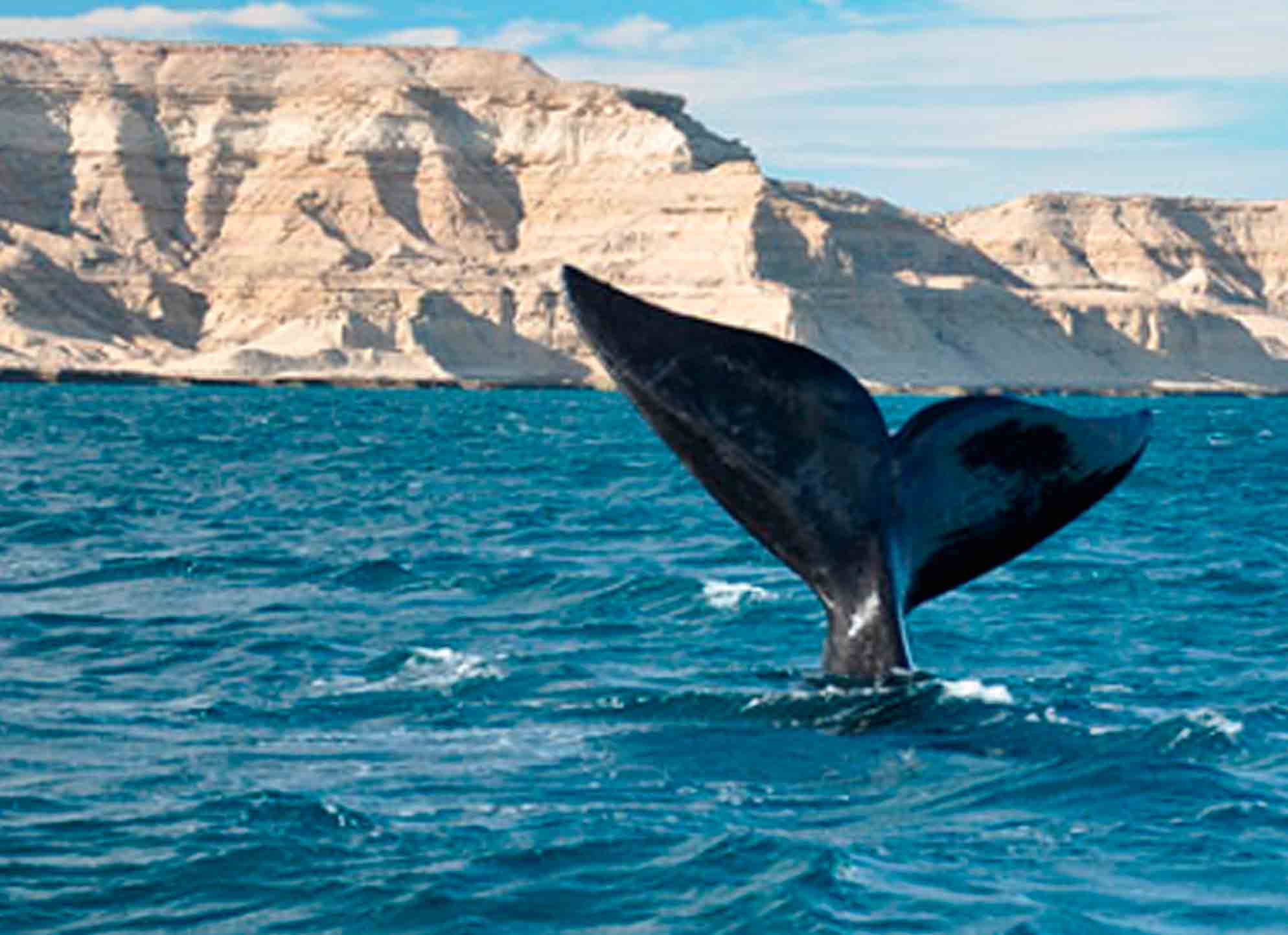
From July to December, Southern Right whales can be seen from the coast of the Valdés Peninsula and Puerto Madryn. They migrate to the peninsula every year to mate.
The cities of Puerto Madryn, Trelew, Rawson and the little village of Puerto Pirámides, (this one in the Peninsula de Valdés), are the entrance to the extraordinary world of the Southern Whale and Dolphins. Every year they come to the coast of Patagonia to accomplish their eternal rite of mating.
An unforgettable excursion of sea fauna watching
The wale watching is done from Pirámides and there are six companies authorized in the Province for this. They take the necessary care not to produce environmental impact and not to alter the whales' behavior.
The trip starts going along the coast in both directions and then getting one or two miles into the sea, to get in touch with the whales.
The Most Scenic Road trip: Driving Route 40
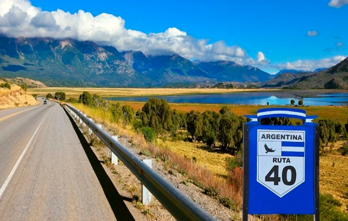
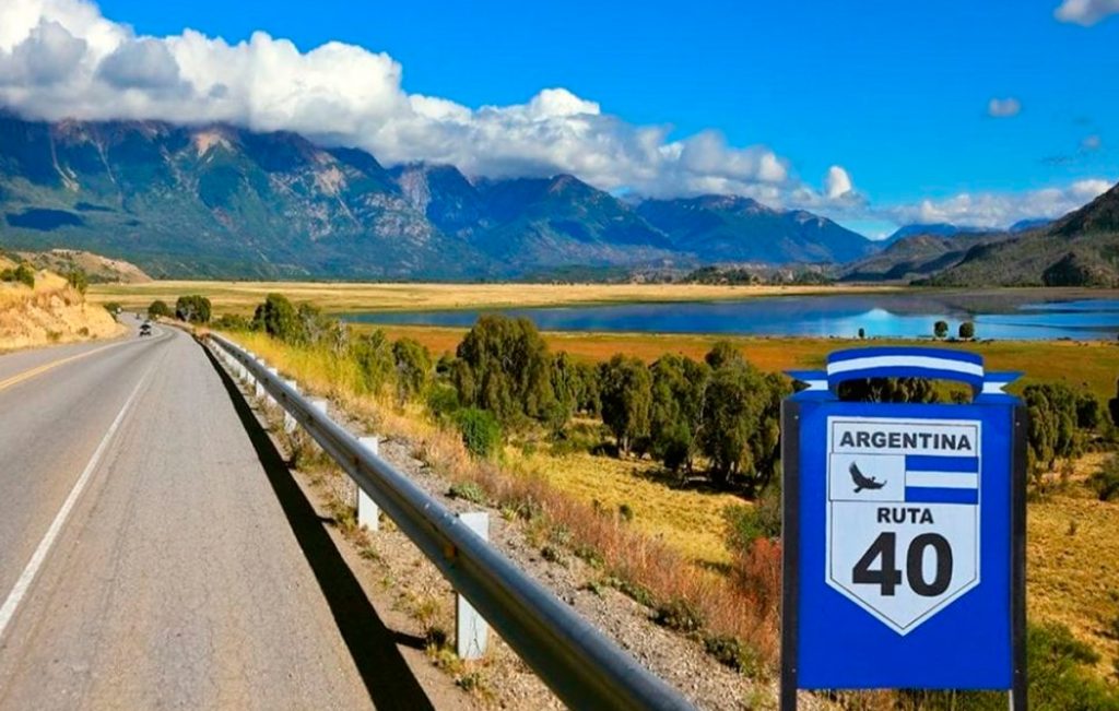
Argentina’s Route 40 is one of the longest and most impressive scenic drives in the world, taking you 3,000 miles alongside the Andes Mountains. With its highest point at more than 16,600 feet (5,061 m), it breaks the world record for the highest national road. The route goes from the southernmost tip of Argentina to the Bolivian border and so the terrain is hugely diverse, from winding mountain passes to expansive open spaces.
Equivalent to Route 66 the “Mother road” in the United States, route 40 is the ultimate Argentine road trip, made famous by its role in Che Guevara’s ‘The Motorcycle Diaries’. It crosses 18 important rivers, 20 National Parks and Natural Reserves and connecting 11 provinces: Santa Cruz, Chubut, Río Negro, Neuquén, Mendoza, San Juan, La Rioja, Catamarca, Tucumán, Salta and Jujuy. On this spectacular route, you’ll pass through everything from wetlands to breathtaking glaciers.
Unesco World Heritage Sites along Route 40
Along its entire length, Route 40 crosses incredible landscapes. Among its main attractions, there are several sites that are considered world heritage.
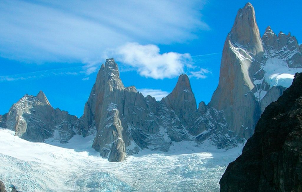
• Los Glaciares National Park: Its natural beauty made it appropriate the UNESCO title. The ice field comprises a vast region of the mountain range. The absolute “star” of all glaciers is the Perito Moreno Glacier, over the south branch of Lake Argentino. It has an imposing front wall of 5 km. and it is 60 meters tall. But there is an even bigger one: the Upsala Glacier,10 km. wide and 50 m. tall. At the north of the Park, another gem: Mount Fitz Roy, a true challenge for mountain climbers with its 3,375 meters.
• Cave of the painted hands: It is an archaeological site in Santa Cruz and, due to its antiquity, continuity over time, beauty and conservation, it was declared a unique pictorial complex in the world. The archaeological and paleontological importance of the site lies in the fact that these paintings of hands, animals and geometric figures made on the rocks are considered the oldest expressions of the South American people. Even in the region, near the Perito Moreno National Park, there are vestiges that demonstrate the existence of life from about 14 thousand years B.C.
Specialists distinguish three stylistic types. The oldest, dating back 9,500 years, shows negatives of hands, hunting scenes and fences with snares, rituals and herds of guanacos. The next one goes from 7,000 to 3,000 years ago and there we can see negative hands, groups of pregnant guanacos and some amphibians and ñandués, and feline figures. The last group, 2,500 years old, shows human figures, schematic hands, geometric figures, concentric circles, zigzag lines, all in vibrant red.
• Los Alerces National Park: The larches that inhabit the forest are one of the longest-lived species on planet Earth. Its thousand-year-old forest earned it the distinction. The alerce trees are massive trees from the cypress family that resemble those of Sequoia National Park in California, United States. The largest known tree in the park is 187 feet (57 m) tall and 7.2 feet (2.2 m) in diameter. It is estimated to be 2,600 years old. The alerce trees are the second-longest living species of trees in the world.
The most popular alerce forest is located on the northern end of Lake Menendez. Boat tours to this region allow visitors to experience this magnificent forest and the park's largest known tree.
The national park is an excellent place to hike and explore the remarkable wilderness.
• Ischigualasto Provincial Park: Also known as the Moon Valley "Valley of the Moon", in San Juan; Talampaya National Park, in La Rioja. Both parks shelter archaeological and paleontological treasures. Ischigualasto covers 63 thousand hectares and only a very limited area is available for tourists; the rest, know it, is the subject of permanent study and research, the exclusive territory of the wise. The visit is only carried out with a guide, who is in charge of illustrating the most relevant aspects that the landscape shows: the amazing Bocce Court where countless spheres of stones are scattered; the figures of the Submarine (with two well-differentiated upper parts) and the Mushroom (with a single wider part); the little towers or watchtowers, on the crest of another mound; The worm; the Los Colorados wall and its ocher yellow plinth, whose colors shine more intensely at sunset; the grayish blue hills, and so many other lunar landscapes that the valley keeps.
Attached to the entrance to the Park is the headquarters of the Museum of Natural Sciences of San Juan. The function of the museum lies in showing the scientific importance of Ischigualasto, which are the most outstanding species that have been found and what the work of a paleontologist is like with the fossil remains found in the place. Biology and geology students are in charge of transmitting their experiences in this field in a didactic and entertaining way for any age. And the boys in particular have a blast; Full of enthusiasm, they ask questions that adults don't always dare to ask.
• In the museum you can see the replica of the Eoraptor lunensis, the great discovery of the Ischigualasto basin, considered the most primitive dinosaur in the world. Almost a meter tall, it has morphological characteristics that place it as the least evolved of the dinosaurs that lived together in the Triassic.
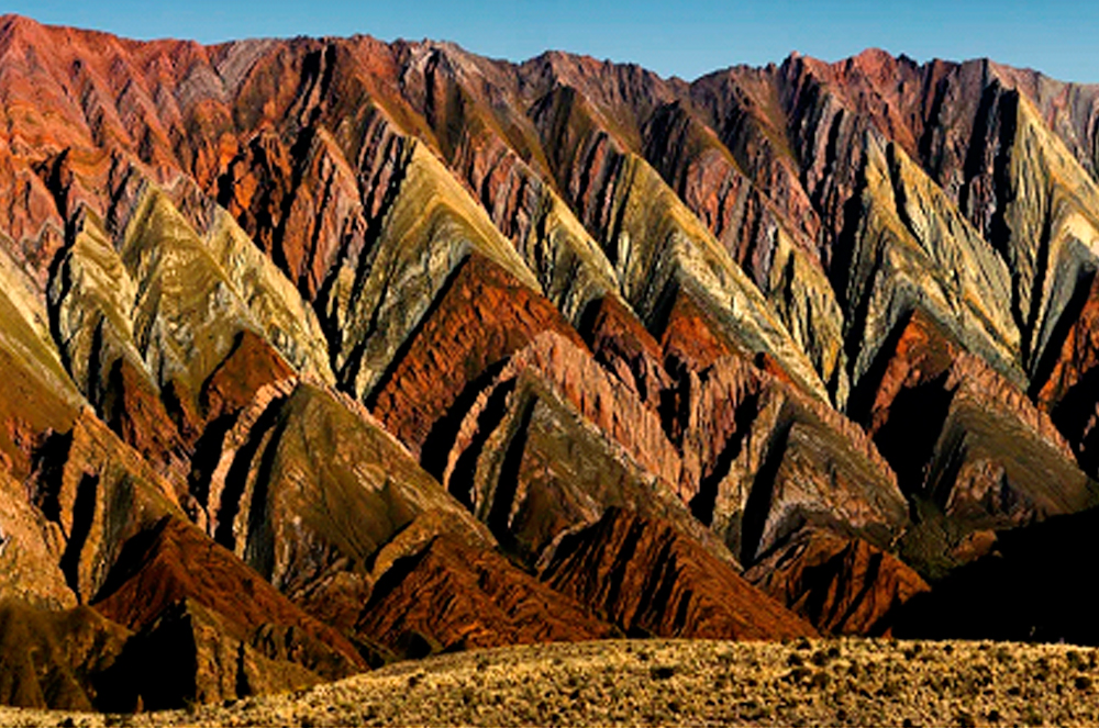
• Humahuaca. The towns of the ravine crossed by the Grande River interweave their cultural roots in a perfect combination of landscape and archaeological heritage. Along 155 km, the narrow valley that fertilizes the Grande River keeps enclaves more or less known and some little visited such as Volcán, Tumbaya, Sapagua, Huacalera, Maimará, among others.
Geological wonders aside, Quebrada de Humahuaca holds the story of Argentina itself. The desert valley has preserved evidence of life dating back 10,000 years, from early hunter-gather tribes to pre-Hispanic communities, Incan culture, Spanish colonizers, all the way to the struggle for independence in the 20th century.
What is the best time of the year to drive Route 40?
Autumn and spring are ideal for traveling along Route 40 in any of its sections, due to the milder climate along its entire length. In Patagonia it is low season for tourism. Driving on the road does not require as much extreme care as if it were winter. And the colors explode in these times, showing all that is wonderful in nature.
In the north there is a coexistence of the mountain climate with the subtropical climate and the rainy season is summer. Autumn leaves behind the high temperatures and the climate becomes drier and more temperate.
Winter is also a good decision to explore the landscapes of the northwest, since the cold is not extreme and when the sun comes out it allows you to enjoy a little warmth on your skin.
Mendoza is considered the land of the sun and good wine. This idea can be extended to all of Cuyo. The warmest temperatures are in autumn and spring. Summer tends to be rainier. Winter is not so harsh and allows you to enjoy the outdoors.
Along the route to the south, the summer season tends to be a good option, especially in the southernmost Patagonia, when the routes are freed from ice and snow. Summer and the first days of autumn are optimal choices. The days are longer, ideal for enjoying the beaches of the southern lakes.
How to plan this trip to Route 40
You should plan at least 10 days to two weeks for your Route 40 trip, even more if you really want to enjoy the route. If you are in a hurry, the road can be covered in 8-10 days.
Keep in mind that to travel certain places such as climbing the Abra del Acay in the north as well as to travel some ranch roads in the south you may need an all-terrain vehicle.
You will have an absolute blast and driving the Ruta 40 will remain as one of our stand-out experiences of your life. But you do need to be prepared.
Traveling so many miles and covering such an important extension has its challenges. It's not the kind of trip where you can just hop in the car and set off. Large extensions of Patagonia are completely deserted and road sections are unpaved. On long stretches you will not find gas stations, places to buy food, nor will you find help to change a tire.
Scenic Drives: The 15 best places to visit on Route 40
Scenic Drives:
The 15 best places to visit on Route 40
Ruta Nacional 40 is the name of a very scenic drive in western Argentina, stretching from Santa Cruz Province in the south to Jujuy Province in the north. Running parallel to the Andes mountains, Argentina’s Ruta 40 is one of the longest and most spectacular highways in the world. Ruta 40 now starts at the ocean at Cabo Vírgenes and winds north through eleven provinces, past twenty national parks and across 24 major rivers, before reaching the altiplano.
Choosing the best attractions and destinations along Route 40, Argentina is not an easy task because there are many sites, natural and cultural monuments, historical landmarks, incredible landscapes and cultural events along its winding route.
Here we list the “15 Best Attractions” of Route 40 that we consider unique and worth visiting. These attractions are listed from north to south.
# 1: Cusi Cusi
The “Valley of Mars”
Jujuy Province
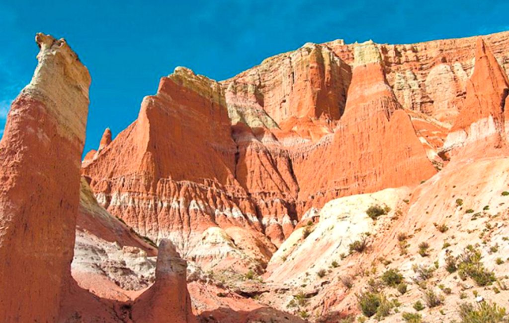
A multi-colored valley with ocher, red, pink, white and gray tones, located on the Plateau de la Puna in the province of Jujuy.
It is also known as “Valle de la Luna 2” (since Valley number 1 is Ischigualasto in San Juan). The Cusi Cusi Valley is located at an altitude of 3,800 m – 12,460 ft on a gravel (gravel) stretch of Route 40 between Susques and La Quiaca.
# 2: Salinas Grandes
Salinas in the Puna
Jujuy and Salta
The “Salinas Grandes” (which means “Salinas Grandes”) extend for 212 km2 in the highlands of the Puna at 3,450 meters high.
The vast surface of white salt contrasts with the deep blue sky. It is a temporary lake when it rains, and the salt is harvested using traditional methods. It is located on the border of the provinces of Jujuy and Salta, and the “old” Route 40 runs along its southern and eastern shore. National Route 52, paved, crosses it and connects Susques and Purmamarca.
# 3: Abra del Acay
The highest point on Route 40
Jump
The Abra del Acay is the highest pass on a national highway in the world and the highest highway pass outside of Asia: it stands at 16,050 feet. (4,895 m) above sea level.
Located in the Cordillera del Nevado del Acay de los Andes, it is a difficult mountain road between the towns of San Antonio de los Cobres and Cachi.
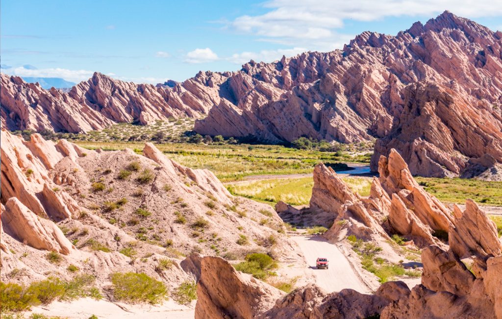
# 4: Quebrada de las Flechas
Incredible rock formations in the Calchaquí River Valley
Jump
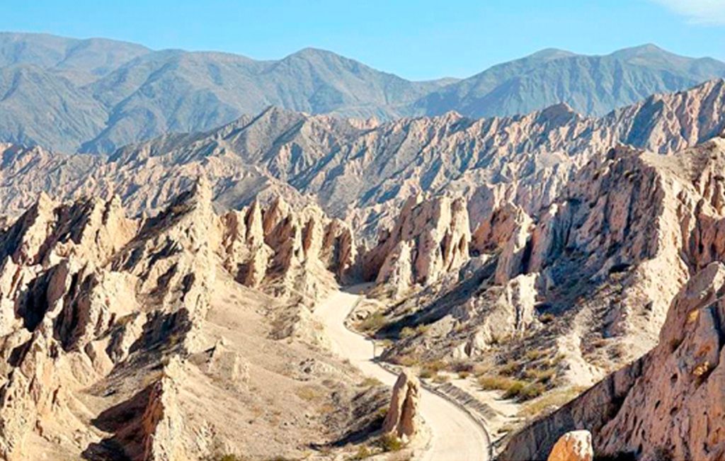
A lunar landscape in the heart of the Calchaquí Valleys. Strange sloping layers of ash-colored rock protrude up to 150 feet above the surrounding terrain.
Its name means “Barranco de las Flechas”, where the “arrows” are the sharp angular slabs of rock.
They are part of the protected area, the Angastaco Natural Monument.
# 5: Shinkal de Quimivil
Prehispanic ruins
Catamarca
The Shinkal (or Shincal) is a National Historic Monument that preserves the Inca ruins.
It covers nearly 50 acres of what was once a provincial capital in the Inca Empire. More than 100 buildings, including a “pyramid”, are on the site.
It is located on the outskirts of the city of London (London), along Route 40.
# 6: Cuesta de Miranda
The Rioja
La Cuesta de Miranda, is a section of Route 40 that was famous for its dangerousness: a narrow one-lane road that winds through the Miranda River canyon. It crosses a gap between the 19,000-foot-high Famatina Mountains and the Cordillera de Sañogasta.
It is now a paved road and it is safe and easy to drive. It is located between the towns of Chilecito and Villa Unión in the province of La Rioja and its maximum height is 6,690 feet. (2,040 m) above sea level.
# 7: Talampaya and Ischigualasto
National and Provincial Parks and a UNESCO World Heritage Site
La Rioja and San Juan
Both parks are part of the UNESCO World Heritage Site, the Talampaya National Park is located in the province of La Rioja, and is next to the Ischigualasto Provincial Park in the province of San Juan.
They are known for their rock formations, dinosaur fossils, pre-Hispanic rock art, and their native animals and plants. You can get from Route 40 to Jáchal, Huaco or Villa Unión.
#8: Cerro Aconcagua
Mendoza
Cerro Aconcagua, often referred to as simply Aconcagua, is a mountain in Argentina near its border with Chile. Aconcagua is the highest peak in the Western Hemisphere. It is second in height after Mount Everest. The first known attempt to reach the mountain’s summit was made in 1883, but the attempt failed. In 1897, Swiss mountaineer Matthias Zurbriggen became the first known climber to successfully reach the summit. It is more than 6,706 meters (22,000 feet) high, Aconcagua is part of the Andes Mountains chain and it is one of the Seven Summits.
# 9: El Payén
La Payunia Provincial Reserve
Mendoza
El Payén or Payunia, is a volcanic region with large lava flows, basaltic rocks and volcanoes.
It averages 2.75 volcanoes per 10 square miles and disputes with the Siberian Peninsula of Kamchakta for the title of “most volcanoes in a given area” worldwide.
Its lava flows and lava fields are among the largest in South America.
# 10: Route of the Seven Lakes
Route 40 in the Patagonian forests and the lake region
Neuquén and Río Negro
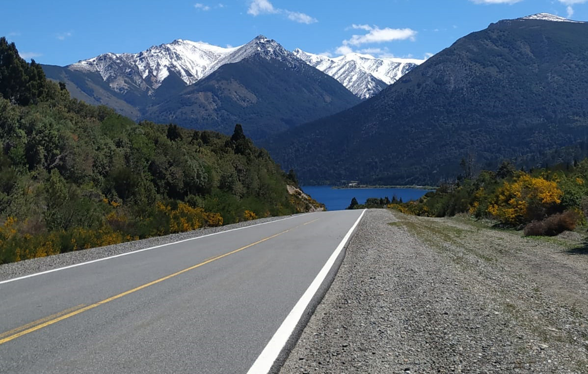
Route 40 between the cities of Bariloche, Río Negro and San Martín de los Andes in Neuquén is known as the “Route of the Seven Lakes”.
The road is completely paved and crosses two National Parks, in the Andean forests and runs along the shores of more than seven lakes today. The highway is aligned in the Andes, with its forested slopes, a pristine area protected by the Nahuel Huapi and Lanín National Parks.
# 11: Bariloche
Bariloche is the gateway city to the Andean lakes district in Argentine Patagonia. This alpine-style town is known for its high quality Patagonian food, high quality chocolate and the beauty of its unspoiled nature. It is located very close to Cerro Catedral, the largest ski resort in South America. There are many reasons to visit Bariloche: the beauty of unspoiled nature, horse riding, fishing, trekking & hiking, navigation, mountain biking, rafting, kayaking, canopy, snow and ski, amongst other outdoor sports. n Bariloche there are many different accommodation options to suit all needs and budgets: luxury hotels, lodges, hostels, apartments, cabins, youth hostels and camping sites.
# 12: The Cave of the Painted Hands
One of the most important Paleolithic detachments in the world
Santa Cruz
Declared a UNESCO World Heritage Site, the caves of the hands offer a trip to the past to understand the life of the Indians of Patagonia.
# 13: Petrified Forest La Leona
The Petrified Forest closest to Tourism
Santa Cruz
Just 100 kilometers before reaching El Calafate is the most easily accessible Petrified Forest.
#14: Fitz Roy Mountain
El Chalten, Santa Cruz
The hike to Mount Fitz Roy is one of the most popular hikes in Los Glaciares National Park and the village of El Chaltén. It’s most often done as a long day trip, but if you prefer to take your time there are two campgrounds along the route.
# 15: Perito Moreno Glacier
The most famous glacier in Patagonia
Santa Cruz
The Perito Moreno glacier is unique in that it does not recede, but advances, damming Lake Argentino, periodically bursting in a spectacular rupture of the ice dam when the pressure of the lake’s water breaks it.
It is located in Los Glaciares National Park, a UNESCO World Heritage Site, near the city of El Calafate.
SMART PLANNING
The extensive route of Route 40 requires a lot of research and planning time. We highly recommend working with a local expert to travel safely and with peace of mind. Our travel designers are always up to date with the latest news and guidelines.
Throughout your trip you’ll have in-country support ready to jump in and take care of any eventuality. You can take it easy, knowing you’ll be fully supported even when the unexpected happens.
Fernando de Noronha. Brazil most beautiful and exclusive beach paradise
Fernando de Noronha
Brazil most beautiful and exclusive beach paradise
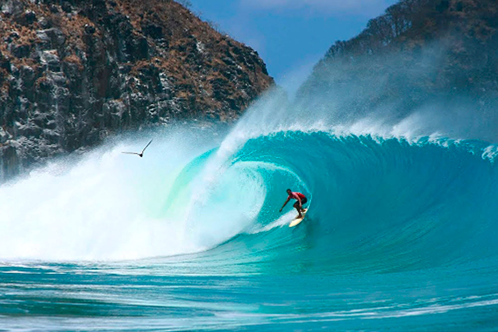
Any list of “Brazil’s most beautiful beaches” must have at least five of Fernando de Noronha on its Top 10. Fernando de Noronha is an archipelago located 350km off Brazil’s northeast coast. The archipelago belongs to a protected national marine park that was created to preserve the abundant ecosystem of the area. The surf spots in Fernando de Noronha are considered to be the best in the country due to the fact that the volcanic island doesn’t have any continental shelf to reduce the power of the swells. The main source of waves come from the North Atlantic lows and the best time to surf in Fernando de Noronha is from November to February when the waves rarely drop below 3ft. The best surfing area is on the eastern coast of the main island and the best surf spot is Cacimba do Padre that has a powerful beach break with hollow barrels both for the left and the right. If you visit Brazil you should highly consider making a stop at Fernando de Noronha and find out why this is considered as one of the most beautiful places in the world.
The archipelago is also an important reserve preserved as a National Marine Park; in 2001, UNESCO designated Noronha as Natural Patrimony of the World – fauna and flora are strictly preserved, and there are protection plans for marine turtles and spinner dolphins, frequently seen in the region. A trip to Noronha is a ticket to retiring from the real world for a while and dedicating yourself to paradise on earth, as a family, group or couple.
What to see and Do
Under the Sea
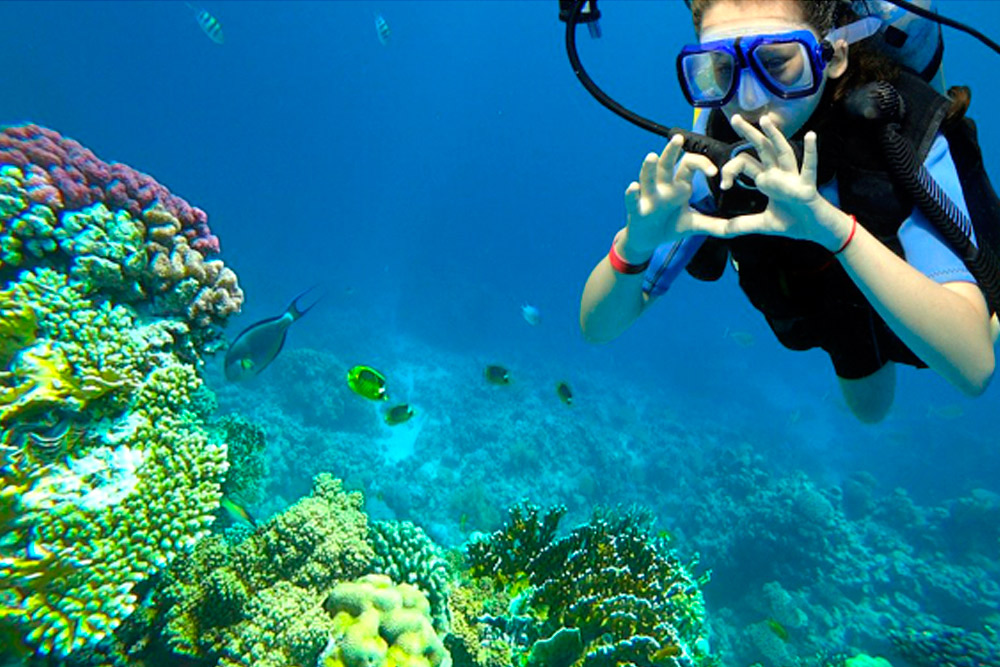
Noronha is world famous among divers. Get to know more about Scuba Diving in Fernando de Noronha. Fernando de Noronha is one of the best diving areas in Brazil. Its clear waters with an optimum temperature of 28-30 Celcius ( 73 - 86 Fahrenheit) and visibility of around 30 m ( 98 ft) allow for viewing the varied and sometimes endemic marine life in over 20 dive sites around the island, including:
Scuba Diving in Fernando de Noronha
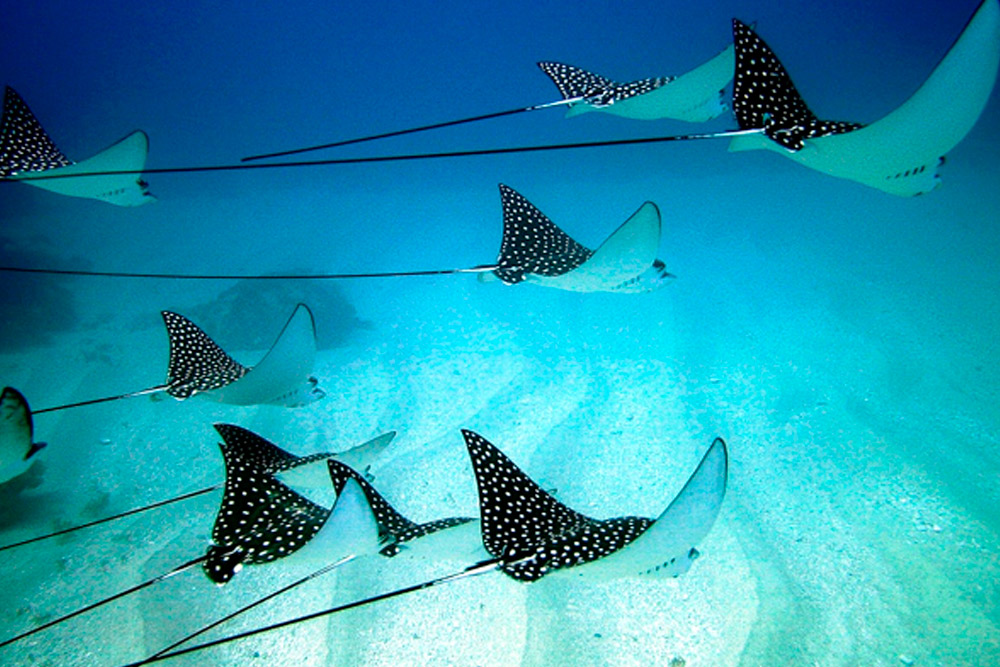
Below 20 m (66 ft) depth dive sites Pedras Secas (17m - 56 ft), regarded as one of the top 10 dive sites in the world, has an impressive rocky formation of tunnels, caverns and canyons, covered with corals and sponges. Squirrelfish, black margates, grunts, sea turtles and sand sharks frequent this spot. Buraco das Cabras (16 m - 52 ft) is one of the most vibrant diving areas, with a plethora of colors emerging from the rock formations, and huge variety of marine and plant life seen here such as manta rays, barracuda, turtles, angelfish, octopi, hammerhead sharks, lobsters, blackjacks, corals and sponges. Morro de Fora (15 m - 49 ft) is a nursery site with several infant species, including flounders and queen angel fish. This and Cagarras Rasas (16 m - 52 ft) where fire coral and a huge number of beautiful ornamental fish can be viewed, such as surgeons and damselfish, are good spots for beginner divers. 20 – 40m ( 66 - 131 ft) dive sites Laje dos dos Irmaos (24m - 79 ft) is the largest coral covered dive site of the island and attracts reef sharks and schools of chromis, hawksbill turtles, horse-eye jacks and fine bearded sharks. At Iuias (24m - 79 ft) rock formations, covered with coral and sponges, have created narrow passages and fissures, where schools of fish take shelter. Sightings of big fish like jewfish and black grouper are often made as well as nurse sharks and eagle rays. Carragas Fundas (30m - 98 ft) is a wall dive with great flora and fauna biodiversity and rare reef fish such as gray angelfish and rock beauty can be spotted here. Cabeco Submarino (20 m - 66 ft) is probably the best dive area for turtle lovers. Above 40m (131 ft) dive sites Cabeco da Sapata (43 m - 141 ft), an excellent multi-level dive site, only suitable for advanced divers, due to the depth and strong currents, is a small submarine mountain that rises nearly above the water level. Here triggerfish, grunts, chromis and horse-eyed jacks can be found. Pontal do Norte (45m - 148 ft) is a huge submerged rock where large sharks, black groupers, snappers, rock hinds and hawksbill turtles are often sighted. Corveta V 17 (63m - 207 ft), with the well preserved remains of a sunken naval ship, is considered one of the best wreck dives in the world. Marine life frequenting this site includes mahi mahi, tunny fish, manta rays, mackerel, eagle rays and sometimes even a whale shark. Advanced divers can explore the interior of the vessel. Snorkeling and diving are perfect aquatic activities in Noronha, even for beginners. The best levels for independent diving range from 8 to 60 meters deep and visibility is up to 30 meters of range. Schools of fish, rays, turtles, rocky formations, coral reefs and shipwrecks are visible in the region. There are several diving operators on the island who will provide equipment and training; we are happy to liaise with them for you.
Stunning Beaches
If you love the idea of remote and isolated beaches even during peak season, Noronha is perfect for you. With a strict control on the number of visitors at any time, beaches in Noronha remain quiet all year round. Very few have beach bars or any kind of infrastructure – a scenario which many modern travelers crave for. We think some of the most beautiful beaches in Brazil are located here. Easily. Baia do Sancho is a unique reddish brown sandy beach which requires access by bolted iron ladders. Baia do Sueste is an amazing snorkeling spot ideal for kids due to its shallow waters. At any given day, only thirty people are allowed at the Praia do Atalaia. No sun tan lotion, please. Natural pools are the attraction here formed by the extension of volcanic rock shelf along shores. What about surfing? Praia da Conceição, Cacimba do Padre, Praia do Cachorro, Praia do Boldró, Praia do Meio, and Praia do Bode.
Surfing & beaching
From November to April good swell waves can be found on beaches such as Laje, da Cacimba, Boldró, Ruro and Abrás, which are favorites and very popular with surfers from all over the world. National and international surfing championships also occur in Noronha during that period. If you prefer to sit back on the sand and just enjoy the beach, we highly recommend that too! In Noronha your time can be spent as actively or laid back as you choose.
Best surf spots in Fernando de Noronha
The best and most famous surf spots are Cacimba do Padre, Abras, Praia da Conceição and Boldró.
Exploring Noronha
The island of Noronha is a manageable destination for travelers to explore by buggy, with or without a guide. The highlight is that all the beaches are beautiful, without exception, the clear turquoise sea and the wilderness of each one is stunning. Some places are even more striking than others: Leão and the beaches on Sancho and dos Porcos bays are must do’s; but don’t miss the chance to visit the village known as Vila dos Remédios. Trekking is also a good way to venture around the island.
Feast your eyes with dolphins
Fernando de Noronha is home to the largest concentration of spinner dolphins in the world. The spinner dolphin is the most acrobatic of all dolphin species with incredible jumps out of the water. Practically all-year round, colonies of up to 2000 dolphins can be seen around the island close to sunset, so get on a boat and enjoy this marvelous sight.
Start Planning your Trip
Ideas can plan every step of your trip, allowing you to relish the tremendous adventures and wonderful sights of Brazil, knowing that Ideas will be taking care of all the details.
What is Bariloche known for? Is it worth visiting?
San Carlos de Bariloche is the gateway of Andean Patagonia. As part of the Patagonia, it features excellent weather and geographic conditions for mountain activities such as trekking, bike tours, kayaking, paragliding and glamping. In the suburbs of the city of San Carlos de Bariloche, we find the ski center Catedral one of the most important centers in the southern hemisphere and permanent venue for Ski and Snowboard Tournaments for both professionals and amateurs. Nautical sports become popular in summer while the lake banks attract tourists with the first strong sunshine. Golf also has formidable courses for its practice. Besides, this province hosts important valleys devoted to the production of fruits and vineyards and cities with many cultural options that are worth to be known.
What can you do in Bariloche?
• Sail to Victoria Island and explore Arrayanes Woods;
• Visit Villa la Angostura is a beautiful resort town on the northwestern shore of Lago Nahuel Huapi;
• Play Golf at Arelaufken Golf Club;
• Do a trek to Cerro Lopez;
• Kayak along Moreno Lake & Picnic in the Mountain;
• Taste the best Chocolate in one of the chocolate stores on the main street of Bariloche;
• Don’t forget to visit one of the local Beer houses and try local Craft Beer which are a classic in this destination.
• Make time to get out and take pictures or picnic by the water during your full day of sightseeing.
Weather in San Carlos de Bariloche
Temperature
The Southern Hemisphere summer starts in December and ends in March, when the average daily temperature is 77ºF (25ºC) and at night 50ºF (10ºC). The ski/snowboard season runs from mid-June to early October, and the fishing season goes from November to April.
During the month of October you are most likely to experience good weather with pleasant average temperatures between 20 degrees Celsius (68°F) and 25 degrees Celsius (77°F).
The months May, June, July and August have a high chance of precipitation.
HIGHLIGHTS OF BARILOCHE AND THE LAKE DISTRICT
Gastronomy:
• Regional Cuisine experiences
• Discover and taste local food, indulge the regional cuisine of Patagonia & Argentina. You may love to experience a cooking class with a renowned chef, try the Argentine Mate, savor a typical Asado Patagónico or cook a fresh trout;
• Gourmet Picnics at exclusive locations;
• Experience gourmet travel experiences and custom made bespoke tours;
• Delicious gourmet Picnics in privilege places;
• A romantic toast in a wild location;
• Exclusive and intimate candle light dinner;
• Wine by the Lake Adventures;
• Hand selected Argentine Wines & Restaurants;
• Argentina is recognized for award-winning wines, specially “Malbec”, most of our trips includes wine tasting experiences and premium wines.
• Discover the best Gourmet Restaurants of Bariloche and Lake district of Patagonia.
LUXURY AND SHOPPING
• Local designers;
• Luxury Resorts and Hotels members of LHW and Relais and Chateaux;
• Private Polo Lessons in exclusive Estancias;
• Access to several private golf clubs;
NATURE AND ADVENTURE
Here are some of the most popular activities most people choose to do while in Bariloche, Villa la Angostura or even San Martin de los Andes:
• Biking & Cycling trip
• Multi-Sport Adventure
• Guided Treks & Hiking
• Kayaking Expeditions
• Mountaineering Ascents
• Heli-Adventures
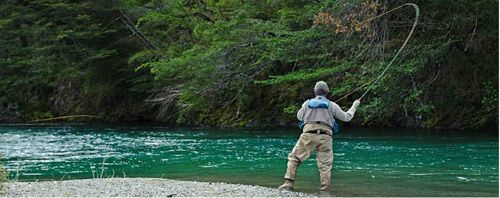
• Fly fishing trips
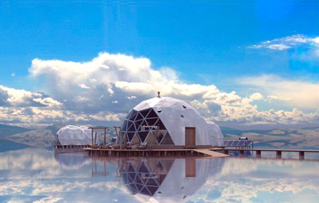
• Glamping activities
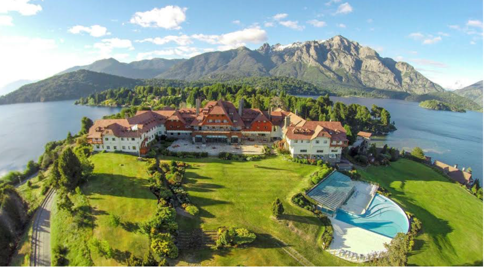
• Play golf at several private golf clubs (Llao Llao has one of the best golf courses of Patagonia).
• Sailing Nahuel Huapi Lake and visit Victoria Island and Arrrayanes Forest
Regional leader for meetings and events, companies and organizations choose Bariloche for their events and conventions, captivated by the Patagonian gastronomy, the Andes mountains and luxury hotels with wonderful views. A unique destination for truly once-in-a-lifetime events.
G20 Meeting in Bariloche, Patagonia.
Share a trip of a lifetime in Bariloche with the people you care about the most: your favorite friends, family members or colleagues. Simply choose your date and interests, and our travel expert will handle all the details.
The Best Day Hikes in Torres del Paine
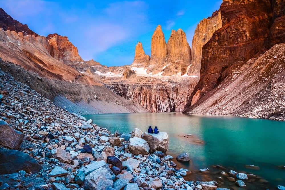
The reopening of the Chilean border in last November saw the first international guests return to Torres del Paine National Park. Simply put, this is the most magical place you will have the privilege to visit. From the most remote corner of the world, we seek to inspire our visitors with the amazing nature and culture of Chilean Patagonia. Here are some of the best active tours and experiences that we highly recommend doing while you visit Torres del Paine.
Sierra Masle
Difficulty: EASY
Travel Time: 1 hour
Total Time: 3,5 hours
Starting from the lake shore you will walk up a loop that showcases a few of the different biomes that compose Torres del Paine. It’s a good introductory trek of the National Park and the Paine Complex.
Note: consider reading Florence Dixie’s book “Across Patagonia” beforehand to appreciate how unchanged the landscape remains.
Loma Guanaco
Difficulty: EASY
Travel Time: 45 minutes
Total Time: 3 hours
As the name says it, it’s the place where large herds of guanacos usually roam. These wild South American camelids stand at around 2 meters (7 feet) tall and weigh between 90 and 140 kg (200 to 310 lb) making them one of the largest native terrestrial mammals on the continent. Their presence also provides good chances to encounter other local species like foxes, pumas and condors. Loma Guanaco is on the way towards Laguna Azul, in an area that not many tourists visit, making it a very private and quiet spot. It is possible to combine this activity with other short hikes and highlights in the area.
Estancia Tercera Barranca
Difficulty: MODERATE
Travel Time: 15 minutes
Total Time: 1-4 hours
In Patagonia horses are a big part of gaucho culture, so hiking and horseback riding are two of the best ways to get to know this place. This excursion begins only a few minutes away from our lodge in a nearby Estancia, riding through the steppe with one of the best views of Torres del Paine. The duration of this activity will be determined by the skill level of the riders. The current and prior weather conditions also determine the feasibility of this excursion, since the terrain could be affected.
Note: A minimum skill level and horseback riding experience is necessary.
Sierra Contreras Mountain
Difficulty: MODERATE
Total Time: 2 hours
Sierra Contreras is a a great way to stretch your legs after a long drive or simply contemplate the vastness of the Patagonian landscape. Its 360º views from the top are a good way to get a reference of the area’s highlights and decide on the next the hikes. You will enjoy real-life postcard views of the Paine Mountain Range, Sierra Baguales, Valle de las Chinas and Lake Sarmiento, among other geographical wonders.
Note: It’s well marked, can be done with or without the guide. It’s a loop that can go from 45 mins to 2 hours depending on fitness level.
Aonikenk Trail
Difficulty: EASY
Travel Time: 45 minutes
Total Time: 4 hours
One on the few trails within the park that combines gorgeous landscapes with tangible evidence of the Aonikenk native culture. You will enjoy an easy path with panoramic views towards the Paine Complex and the Patagonian steppe, and observe some evidence of rock art from earlier human inhabitants. If that wasn’t enough, plenty of birds, guanacos and foxes roam the area, which is why this trail is also well known for puma sightings. Due to the location of this trail it is easily combined with other short hikes or drives to the park’s highlights.
Note: Due to the presence of pumas, children younger than 10 years of age are not allowed to do this trail.
Cuernos Lookout
Difficulty: EASY
Travel Time: 1,5 hours
Total Time: 5 hours
At the heart of the Torres del Paine National Park, this lookout is one of the most scenic and comfortable hikes in the area and offers a surplus of photo opportunities. We start walking from Pudeto, passing by Salto Grande Waterfall. After marveling at the power of this waterfall, we walk towards the foot the famous “horns” in a scenery that blends turquoise glacial lakes, calafate bushes and peaceful guanacos. Finally, we are rewarded with the views of Paine Grande, Cuernos and Almirante Nieto overlooking the Nordenskjold Lake.
Note: This is a fairly popular excursion, since it’s one the most accessible hikes within the National Park.
Condor Lookout
Difficulty: MODERATE
Travel Time: 1,5 hours
Total Time: 3 hours
A short but slightly challenging hike that is not well-known to most tourists, yet has one the best 360° views of the National Park. We start close to Camping Pehoe, at the edge of Pehoe Lake and slowly but steadily we gain altitude towards the lookout. Every once in a while condors can be spotted close by soaring over us. The view will (quite literally) blow you away. This hike is located in the middle of the National Park, so it is an excellent add-on to other activities or highlights.
Note: Depending on the wind conditions this hike might not be recommended, as the lookout is exposed to very strong winds. Your guide will be able to determine this checking the forecast.
Estancia San Luis
Difficulty: MODERATE
Travel Time: 45 minutes
Total Time: 1-4 hours
Get the feeling of what the iconic “baqueanos” experienced, riding on the endless yellow Patagonian steppe. Looking onto the Paine Complex towards the east, and north the imposing Sierra Baguales Range. This excursion has the perfect mixture of traditional culture and surreal sightseeing. We can combine it with excursions in the Sierra Baguales Mountain Range and finish our day with some local “asado” (the traditional gaucho barbecue) surrounded by the best scenery and golden light over the Andes Mountains.
Note: We need to cross a river to get to this estancia, so depending on the amount of precipitation and melting snow, sometimes we cannot get to the Estancia.
If you are thinking of going to Chilean Patagonia contact us and we will design a seamless and unforgettable journey. Our local experts take into consideration a myriad of variables and information that can make or break a trip. Rely on us for expert advice and we guarantee a trip of a lifetime.
Best Active Tours in Iguazu Falls
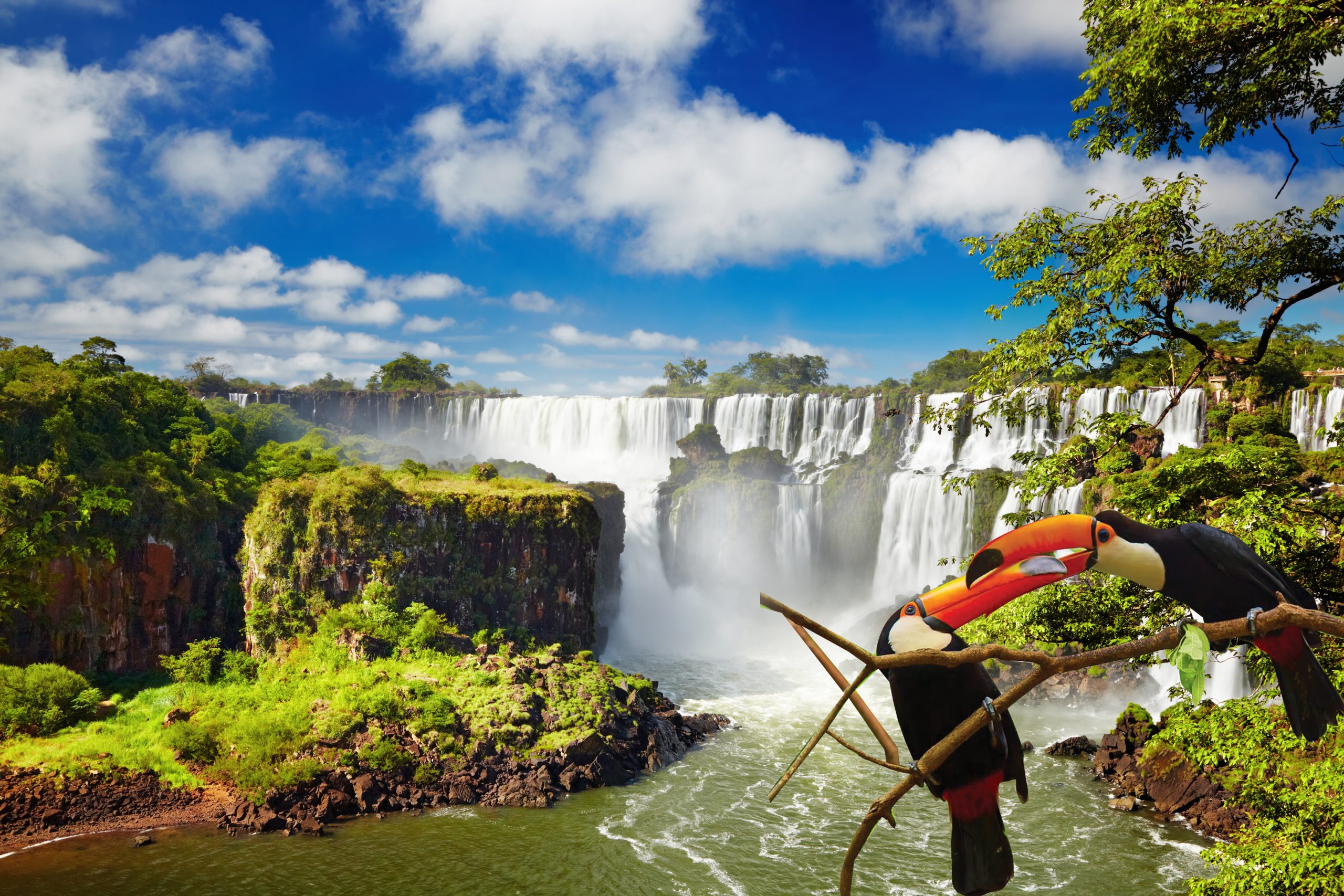
Iguazu Falls sit on the border between Brazil and Argentina on a large horseshoe bend in the Iguazu River, which aptly means ‘big river’ in the local Guaraní language. Winding its way across Brazil for over a thousand kilometers, the river breaks out into the incredible series of waterfalls when it hits the rim of the Paraná plateau. The majority of the falls sit on the Argentinian side, where a well-planned system of trails and walkways let you experience both the upper and lower falls. From the incredible Iguazú Falls to places of natural beauty, here’s a sneak preview of what is waiting for you.
Alto Paraná River & Yasy Fall
Difficulty: EASY/MODERATE
Travel Time: 1 hour
Total Time: 5-6 hours
Duration: HALF DAY
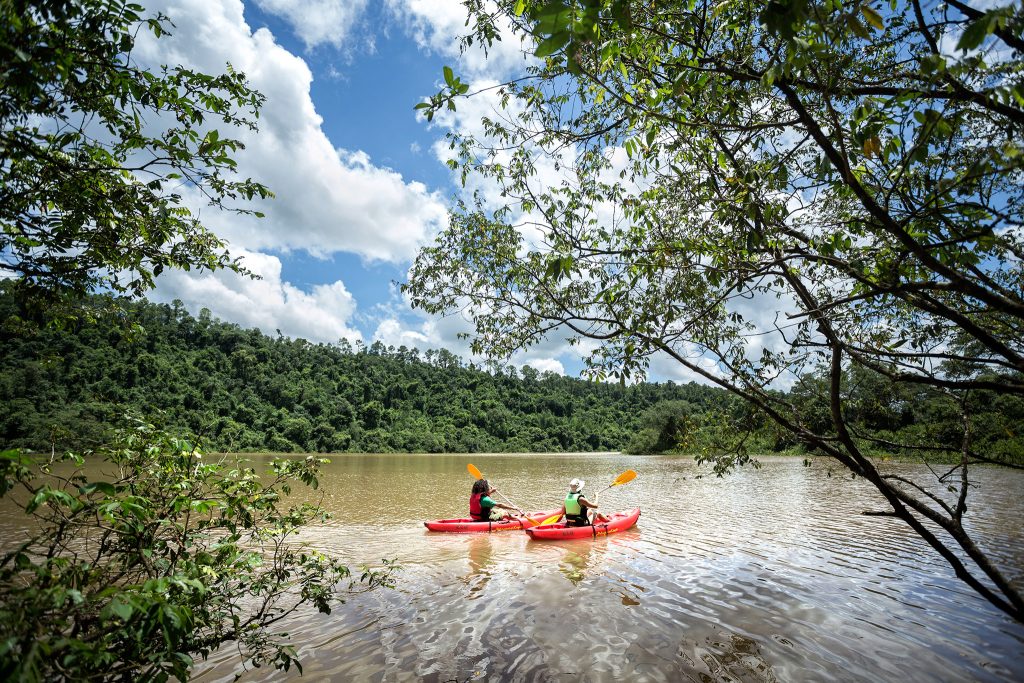
Along the second largest river in the continent, at the point where the jungle meets the Urugua-í Creek, the most unusual geological formations are found. With semiprecious stones encrusted in the rocks, archaeologists believe this was the home of the pre-Guaraní civilizations, as the area provides readily available food and shelter. Explore along the waters of the calm Urugua-i creek, either by boat or kayak, finishing with a refreshing swim in the waters below the hidden Yasí Waterfall.
Note: Local authorities determine if the weather forecast allows this activity to take place, so last-minute changes could occur.
Iguazú National Park - Devil's Throat
Difficulty: EASY
Travel Time: 30 minutes
Total Time: 3 hours
Duration: HALF DAY
Allow yourself to be awe-inspired by the most impressive cascade of the Iguazú Falls, walking right up to its 80-meter (260 feet!) drop. Walk a little over one kilometer on the boardwalks that cross the upper River Iguazú until you reach the massive fall. On the way, appreciate the jungle scenery and enjoy bird watching – there are many swifts in the early morning and at sunset before they return to their nests behind the waterfalls. This excursion can be enjoyed on its own, or combined with the Upper and Lower Circuits of the Iguazu National Park for a full day activity.
Notes: The Iguazu National Park is a Natural UNESCO World Heritage Site and one of the most visited attractions in Argentina. Trust our Guides to suggest the best times to visit in order to avoid the biggest crowds.
Iguazu National Park: Upper and Lower Circuits
Difficulty: EASY
Travel Time: 30 minutes
Total Time: 4 hours
Duration: Half Day Tour
Admire hundreds of waterfalls from every possible angle. You will be able to walk right up to the San Martín, Bossetti and Dos Hermanas waterfalls, each set in lush vegetation boasting with birds, butterflies and coatis. We recommend heading out early from the hotel in order to enjoy these circuits before the crowds arrive, taking a gentle stroll along 3.5 km of walkways. This excursion can be enjoyed on its own, or combined with the Devil’s Throat for a full day activity.
Notes: The Iguazu National Park is a Natural UNESCO World Heritage Site and one of the most visited attractions in Argentina. Trust our Guides to suggest the best times to visit in order to avoid the biggest crowds.
Iguazu National Park - Macuco Path
Difficulty: EASY
Travel Time: 30 minutes
Total Time: 3 hours
Duration: Half Day Tour
A first approach to the Atlantic forest and its fauna in one of the least visited circuits of the Iguazú National Park. With a total distance of 7km, this walk allows visitors to discover the wilder side of this popular park at their own pace. A smaller waterfall of 20 meters, the Salto Arrechea, and the natural pool that forms at its feet marks the end of the way. This excursion can be combined with either the Upper and Lower circuits or the Devil’s Throat for a full day activity.
Notes: bring comfortable walking shoes and a hat or extra sun protection.
Uruguai Lake
Difficulty: EASY/MODERATE
Travel Time: 1 hour
Total Time: 4-5 hours
Duration: Half day tour.
Even though it was originated by a dam, this lake was turned into a natural sanctuary to preserve the quality of its ecosystem. The scarce human intervention, the existence of hidden salt water springs and peculiarities such as a submerged forest favor the presence of animals such as capybaras and otters. We can explore parts of this special landscape by boat or by Stand Up Paddle Board, or simply enjoy the landscape leisurly.
Note: Local authorities determine if the weather forecast allows this activity to take place, so last-minute changes could occur.
Biking tour at El Ñandú - Iguazu National Park
Difficulty: MEDIUM
Travel Time: 30 minutes
Total Time: 3 hours
Duration: Half day tour.
An adventurous bike ride, crossing the red dirt roads in a lesser- visited area of the National Park. After a 30-minute drive we arrive at the starting point, from where we will travel on rough roads surrounded by jungle. We will reach the banks of the Iguazu River, just behind the Devil’s Throat, possibly being able to appreciate some of its mist in the distance.
The Triple Border: Argentina, Brazil & Paraguay
Difficulty: EASY
Travel Time: 20 minutes
Total Time: 2 hours
Duration: Half Day tour
Take a boat ride to the confluence of the rivers Iguazú and Paraná (the second largest river in South America), serving as a natural triple frontier between Argentina, Brazil and Paraguay. This is also the point of origin of the Iguazú Falls, according to geologists. Learn about the history of Puerto Iguazú, visiting the port that initially drove this region’s economy: yerba mate and products of the logging industry were historically shipped out from this point.
Note: Local authorities determine if the weather forecast allows this activity to take place, so last-minute changes could occur.
Yerba Mate Drying Mill
Difficulty: EASY
Travel Time: 1 hour
Total Time: 3 hours
Duration: Half day tour.
“Mate” tea is more than a drink: it is a true cultural icon in Argentina, Uruguay, Paraguay and southern Brazil; and it’s cultivated right here in the province of Misiones. Discover the secrets of the plantations, the drying of its leaves and the production process of one of the region’s main economic engines.
Note: This activity is only available during harvest season (from March to September).
Want to craft your own personalized itinerary? Something totally unique and tailored for you and your friends and family? Well, you’re in luck – we offer bespoke tours too. Just contact us and let us know how we can design you your own perfect adventure in Iguazu Falls.
IBERÁ WETLAND Recommended by the New York Times
Learn about one of the top 52 destinations to visit in 2022 recommended by the prestigious New York Times
DISCOVER THE IBERÁ WETLANDS
The Ibera Wetlands are one of the hidden secrets of Argentina. It is the largest protected area in the country, with 1.3 million acres of pristine wilderness.
Iberá is well-known for its great diversity and abundance of grassland and aquatic species. Over 4,000 animal and plant species reside in the Ibera Wetlands, accounting for almost a third of Argentina’s biodiversity. You will find striking birds such as herons, storks, ducks, southern screamers, spoonbills, kingfishers, cormorants, snake-birds, jacana, rails, plovers and flamingos which stand out in the first group. Plenty of caimans, capybaras, otters, and even the largest population of marsh deer in Argentina are found in these wetlands.
Where is Ibera Wetlands?
Located in the central north-east part of the province of Corrientes of Argentina, Ibera Wetlands is the ideal destination to combine with a trip to Iguazu Falls and Buenos Aires. Depending on which destination you want to visit first, you can fly to Iguazu Airport (IGR) or Posadas Airport (PSS), the nearest airport to Ibera Wetlands. There are daily non-stop flights to both airports from Buenos Aires.
Distances:
Posadas Airport(PSS): 34 miles / 55 km
Iguazu Falls: 217 miles / 350 km
San Ignacio Jesuit Ruins: 68 miles / 110 km
When to go to Ibera Wetlands?
The great news is that you can visit Ibera Wetlands all year-round. If, for instance, you don’t like very high temperatures, you should avoid the summer months (January until March). Choose traveling in Spring (from September through November) in order to find mild temperatures and see many animals.
Where to stay?
Our preferred hotel is Puerto Valle. It is located on the northern gateway of Iberá National Park, on a privileged location since it is the only property that is only a 2-hour flight away from Buenos Aires City, and has convenient access from Posadas airport, a 40-minute ride on a paved road.
Only a 4 hour-ride away from the Iguazu Falls, with the possibility to stop over at the San Ignacio Miní Ruins, a UNESCO Heritage Site, which are only 1.5 h away from the hotel.
Notable Attractions:
- Bird-watching, with over 370 species recorded in the last 10 years.
- Wildlife viewing of the thriving populations of large vertebrates, of which the most remarkable are the caiman, the rhea, many species of herons and storks, capibaras, marsh and brocket deer, pampas deer, armadillos, and fox.
- Explore “The Green Corridor” - a mosaic of landscapes that includes protected areas, private properties for various uses, agricultural colonies and aboriginal communities.
- Visit Ruins of San Ignacio Miní, a seventeenth-century Jesuit mission complex, the most popular ruins of South America.
Conservation Values:
The Great Iberá Park protects large areas of grasslands where many species of endangered birds live, like the Strange-tailed tyrant and the Black and White Monjita. It is also home to important populations of other threatened species, like the pampas deer, the marsh deer, the maned wolf (a.k.a the aguará guazú), the crowned Eagle and a high diversity of Paraná fish.
This destination is great for…
- Nature Lovers;
- Travelers looking for authentic experiences in contact with nature;
- Families who want to connect their kids with nature while traveling. Nature-focused vacations enable parents and children to unplug from technology and everyday stresses while using all of their senses to create lifelong memories.
- Travelers who want to spoil themselves. Stay at a luxury lodge and enjoy full board gourmet meals, a private guide and all sorts of activities surrounded by nature.
Why visit Atacama Desert – The driest desert in the world
Why visit Atacama Desert - The driest desert in the world
Make a trip to the Northern Chile desert, a territory of vast horizons, without shadows, where tourism coexists with avant-garde astronomical projects. San Pedro de Atacama is the capital and the starting point to explore its lunar valleys, geysers, salt flats, a sacred volcano and a lagoon where it is possible to float like in the Dead Sea, under a blue sky.
A great place for nature lovers to start or finish an adventure in Chile.
The Town of San Pedro de Atacama
San Pedro de Atacama is the most visited tourist destination in the country. However, before luxury hotels existed there and there were as many tourists on Caracoles Street as on Fifth Avenue, Atacama was a cult destination, for unconventional travelers, for romantic and adventurous hippies. And, in part, it still is. Only now the segment has widened to the point that this desolate portion of northern Chile, pure excess of salt, volcanoes and cracked earth, receives more tourists than the moai of Easter Island and the horns of Torres del Paine.
The largest oasis in the Atacama desert has a stable population of five thousand inhabitants, almost the same number of dogs that roam among the adobe houses – this earned it the nickname of San Pedro de Atacama – a bright white colonial church and, market paradox, one of the most expensive square meters in Chile in its most depopulated region with fewer services.
San Pedro has a tradition of backpackers and hostels, cloned adventure companies that offer sandboarding in the dunes, ascents to volcanoes and any activity to occupy the time in that great desert and a law that forces bars to close at midnight.
Some of the daily tours that can be done from San Pedro:
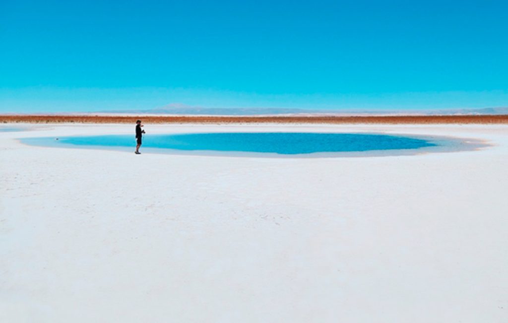
Cejar lagoon and Piedra lagoon
The Cejar lagoon is part of a hydrological basin originated by an accumulation of salts. The most curious thing is that, in the middle of this saline material (of high toxic content), an abundant swampy vegetation grew, called bofedal. These reeds, wild straw and pitches are enough to house small families of flamenco, ducks and seagulls.
In the Piedra lagoon, a few meters away, there are people instead of ducks. They are about ten bodies that barely protrude above the turquoise water, in a horizontal position. They float like corks. This phenomenon happens because our body has a lower density than that of water, whose salt concentration is very high.
Chaxa Lagoon
It is located in the eastern sector of the Atacama salt flat. The thick crusts of salt crunch as you walk along the trails that wind towards the viewpoints. What could once have been a high salinity lake that evaporated is today, they claim, the largest lithium reserve on the planet.
But the reason why they all come there is to get a belly of highland birds. There you can find the Chilean flamenco, the small parina and the large parina and at certain times of the year Puna plovers, the harrier, the Andean seagull and the Baird sandpiper also arrive. The recommendation is not to get too close because any alarm can scare away any of the birds that gather here.
Tatio Geysers
To get to the Tatio geysers, an ascent is made to 4,320 meters, at the foot of the volcano of the same name. You have to arrive before dawn, and wait for the thermal shock caused by the first rays of the sun with the icy cold of the mountain to raise the fumaroles with a large amount of steam. Its peak is between 6 and 7 in the morning. By the time the sun begins to warm, they no longer look the same.
There are signs that recommend not getting too close because you never know if someone is going to blow water out without warning. In addition, the surface around the geyser is very fragile and if it breaks and one falls into it, it can cause very severe burns.
The fumaroles originate from the contact of groundwater with hot rocks and emerge through fissures in the earth’s crust, reaching a temperature of 85 ° C and about ten meters high.
Moon Valley
Right where the Salar de Atacama and the Cordillera de la Sal meet, this great depression with the appearance of another planet that was once the axis of the dispute with Bolivia is discovered. Giant dunes, salt craters and hills that, due to erosion, resemble accordion bellows, outline a sculptural landscape.
The circuit goes from the Quebrada de Cari, the salt caves –not suitable for claustrophobics– and the Dune Mayor, ideal for climbing when evening falls, to the formation of the Tres Marías.
Stargarzing
A visit to the Atacama desert would not be complete without a stargazing evening of astronomy. Many hotels have their own observatories or can arrange stargazing evening tours. If you want to organize a private stargazing tour, send an email to info@ideasturisticas.com and our experts will send you all options available and help you with the planning of your tour.
Weather, climate and best time to visit
The best time to visit in San Pedro de Atacama in Chile is from January until April and September until December, when you will have a soft or pleasant temperature and none till limited rainfall. The highest average temperature in in San Pedro de Atacama is 20°C in January and the lowest is 11°C in July.
If you are planning on visiting San Pedro de Atacama, contact our team of local experts will help you plan a tailor-made trip based on your preferences and budget